
In order to compare gravity measurements from space with flood information derived from earth observation satellites, a workflow for flood volume calculation based on the combination of SAR scenes during a flood and a digital elevation model (DEM) has been developed.
First of all, the water mask of the flooded areas had to be extracted from ENVISAT ASAR and Sentinel-1 data. Afterwards, a DEM is clipped so only flooded pixels with height information remain. Over those pixels a fishnet grid is laid in order to compute a histogram for each grid cell. For each of those histograms a threshold is calculated to separate “real” flooded pixels and such with unrealistic height information. Afterwards, pixels which are defined as flooded are summed up in total to receive the volume of water stored during flooding. This workflow was already tested with ENVISAT ASAR data in combination with the SRTM DEM. Results have been produced for seven ENVISAT-ASAR scenes which cover the large flood event in Bangladesh during July-October 2007. However, the results also showed that identifying a suitable threshold for flooded pixels is not possible with a DEM having a limited accuracy in the vertical dimension. Hence, a data proposal for TanDEM-X DEM data has been submitted to test the approach with a higher accuracy DEM.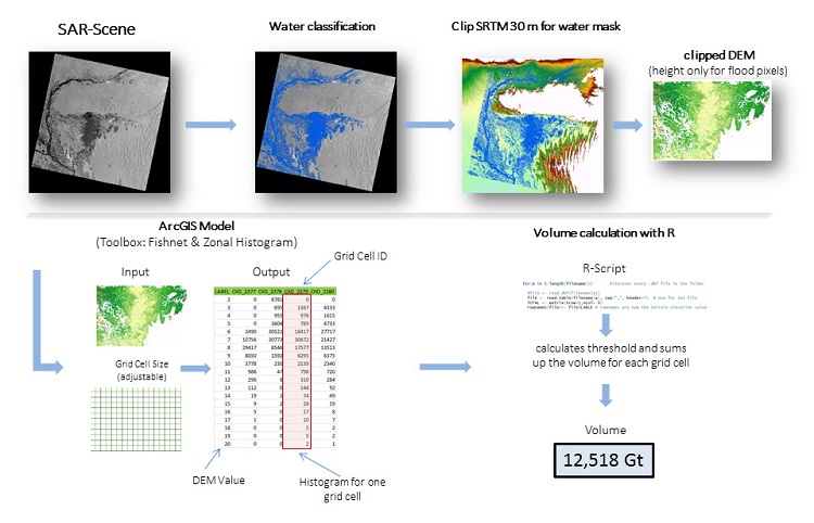
Figure 1: Workflow for flood volume estimation