
Since April 2002, the GRACE satellite mission has been churning out water storage anomaly data, which have been shown to be a unique descriptor of large-scale hydrological extreme events, such as floods and droughts. Nonetheless, efforts to assess the comprehensive information from GRACE on total water storage variations for near-real time (NRT) flood or drought monitoring or forecasting have been limited so far, primarily due to the coarse temporal (monthly to weekly) and spatial (>150.000 km2) resolution, and the latency of standard products of about 2 months.
Now, 15 years later, as of 1 April, EGSIEM launched into a demonstrator near-real time (NRT) daily gravity field service. Compared to the official GRACE gravity products, the NRT solutions not only increase the temporal resolution from one month to one day, but also reduce the current latency from two months to five days. Thus, the NRT service allows for the monitoring of extremes in total water storage variations as they occur, as opposed to a ‘confirmation after the fact’, which has been the situation up to only recently.
Contrary to other earth observation data, gravity represents total water storage variations (i.e., variations of all surface and subsurface water storage compartments). As such, it provides unique information on the wetness state of a river basin with regard to its actual flood generation potential or its susceptibility to a drought. For the development and testing of indicators of such hydrological extreme events, we take advantage of the integrative nature of the gravity data and evaluate how large-scale water storage anomalies derived by NRT, daily and regional GRACE products can be used as early warning indicators in flood and drought monitoring and alerting services.
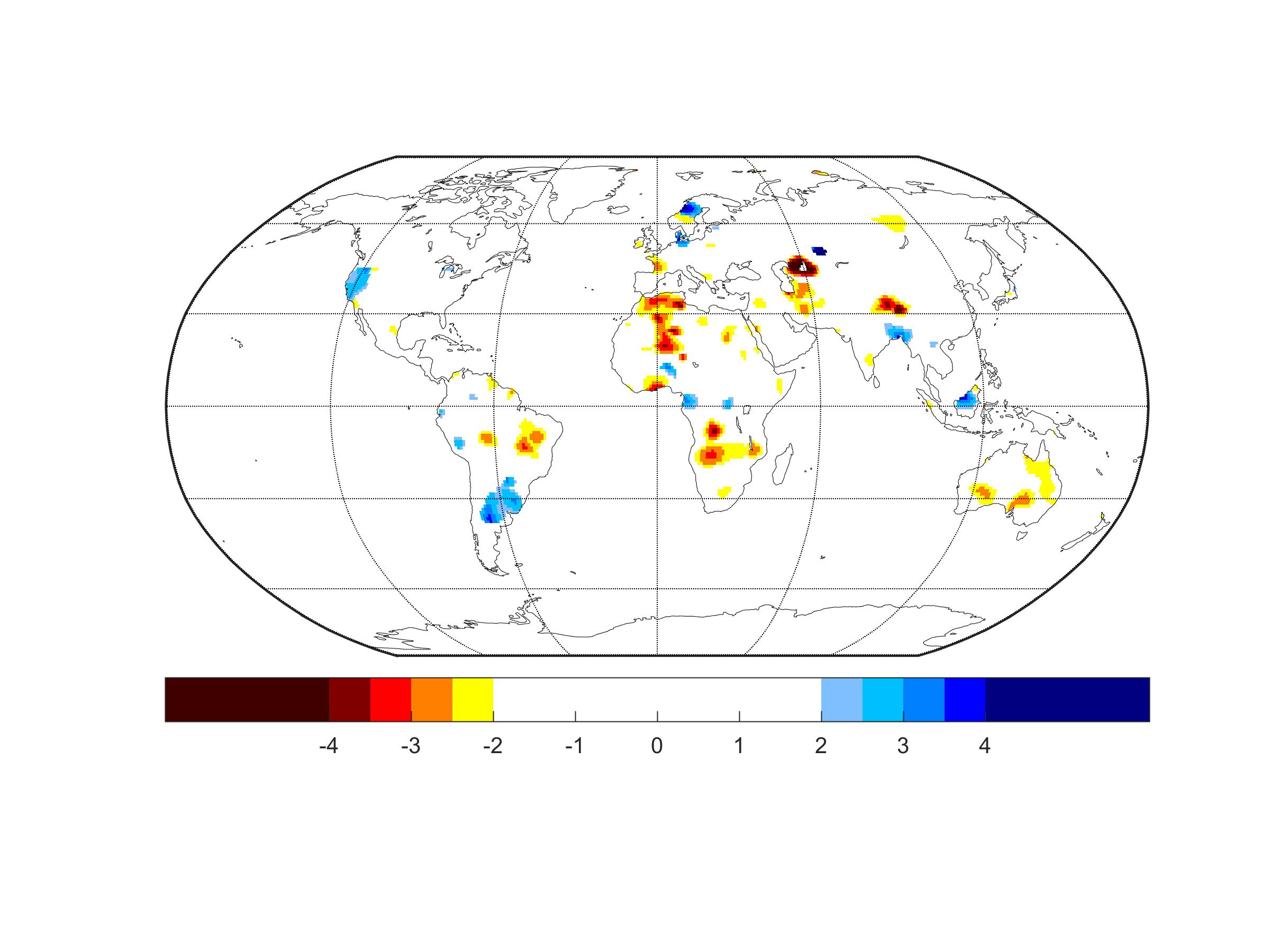
The example above shows the satellite gravity-based Wetness Indicator in near-real time for 3 May 2017. The index expresses the deviation of the GRACE-derived total water storage anomaly (TWSA) from the mean seasonal cycle in units of standard deviation. Wetter than ‘normal’ conditions (2.5-3 times the standard deviation) are indicated for parts in Latin America, signaling ‘El Niño`conditions, prompting flooding conditions, e.g. in southern Columbia and Peru. Hot-spots indicate ongoing drought-related humanitarian crises in Africa (Nigeria, Zambia, Angola, Sudan).
Daily satellite gravity-based Wetness Index updates can be found at: