The GRACE satellites are flying at an altitude of approximately 400 km above the Earth's surface. Due to the attenuation of the gravitational perturbations with altitude, they sense "large scale" variations in the gravity field, to say it simply, rather than "small scale". The smallest perturbations on the Earth surface that they can observe on a monthly basis have a spatial extent of at least 200 to 300 km. In addition to that, the North - South orientation of the tracks - and of the measurements taken by the satellites - imply that there is a weakness in the determination of the East - West components of the solutions. This weakness needs to be in some way alleviated.
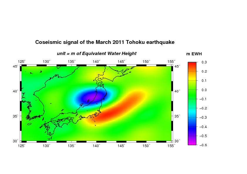
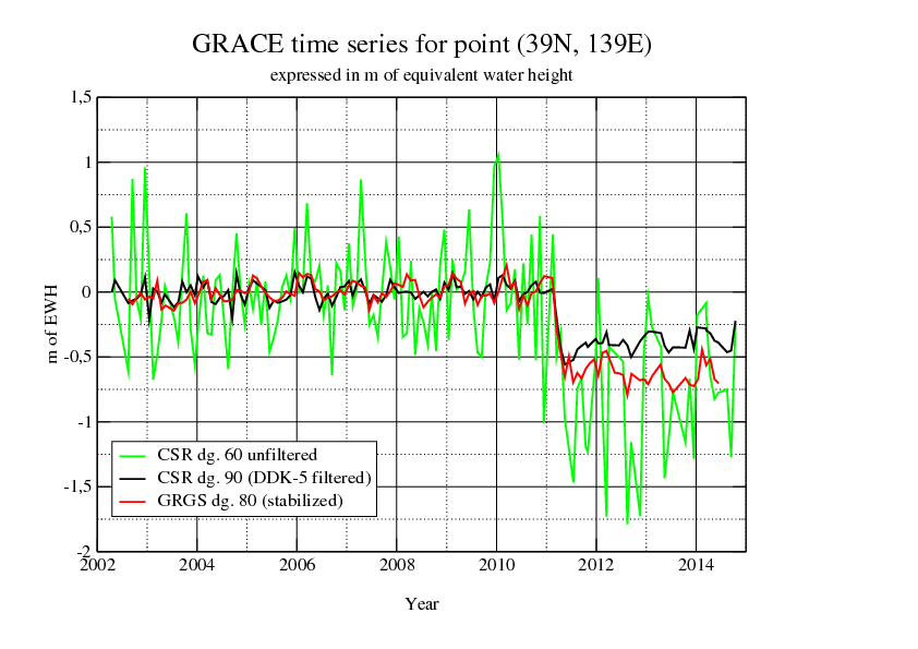
Depending on the strategies chosen by the different solution providers, this can be done either at the processing level, by applying a constraint of stabilization to the solutions, or at the post-processing level by running an anisotropic filter on the solutions. As an example, here are three solutions for a point in Japan (39°N, 139°E) located near the gravitational epicenter of the great Tohoku earthquake of March 2011. In this case we know that the gravitational signal is strong, but with a narrow extent. Thus the amplitude of the signal recovered by the different GRACE solutions is an indication of their better or worse spatial resolution.


The GRGS solution (max. degree 80), obtained using a stabilization constraint, has an advantage over the CSR solution (max. degree 90) which needs an a posteriori filtering (DDK-5 was used, the least severe of the DDK series of filters): the step observed by GRACE is at the level of 65 cm of equivalent water height (EWH) for the GRGS solution and 40 cm for the CSR solution. However, when considering the unconstrained CSR solution (only computed up to degree 60 because otherwise the noise would be prohibitive), it is clear, although the level of noise is much higher, that the real value of the step is closer to 100 cm EWH. So, some information is lost in the stabilization process as well as in the filtering process. The challenge here is to improve the spatial resolution while keeping the noise of the solution at an acceptable level. One of the first aims of the EGSIEM project will be to homogenize and combine the solutions from different European groups in order to minimize their errors by averaging and at the same time try and improve the maximum resolution that can be reached with the GRACE data.
